Wednesday, April 26, 2006

Western Australian Maritime Museum


Again I mentioned the Maritime Museum. I assure you, I have no stake in it at all!

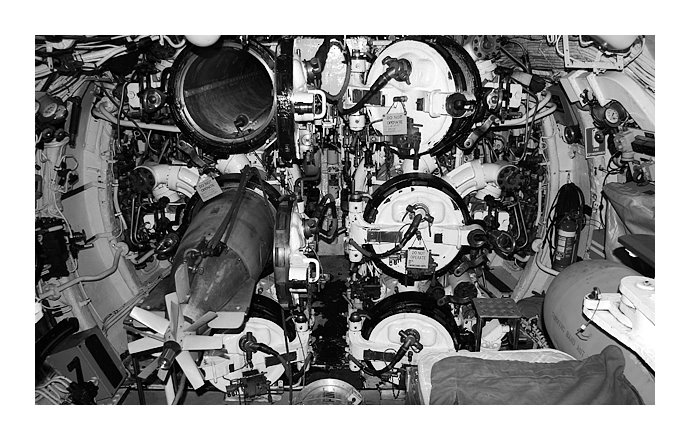
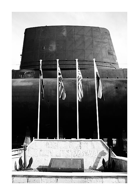
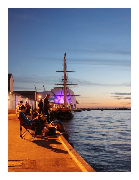
This is a photograph I took on the day I did the submarine tour. The Maritime Museum - opened to the public on December 1, 2002 by the then Premier of Western Australia, Dr Geoff Gallop - has some very interesting displays inside, but its exterior is also quite eye-catching. From some angles, the sail-like roof looks somewhat like a sail on the Sydney Opera House. It is, though, not the Sydney Opera House, it is the Western Australian Maritime Museum and I give the design my two thumbs up!

Vantage point: 32°03'17.10" S, 115°44'17.60" E

Wednesday, April 19, 2006

A Tour of the Submarine Ovens


In a previous post, A Submarine Memorial, I mentioned that I heard about the submarine tour being something well worth checking out. Well, I thought I'd go and experience it for myself.

The image above is the first little enclosure we ventured down into. I don't think it needs much explaining - it is the area where the torpedoes get launched. Our tour guide was a former crewman of one of these submarines and had some very interesting stories. It's hard to tell, but in the bottom right of the photo you can see the top of a small bed (a very, very small bed, as are all of them on a submarine). He told us that when he slept there, although one spark could spell the end of him instantaneously, it was a unique feeling knowing that he was sleeping on one of the most expensive beds in the world, atop a $4.5 million torpedo.

I would certainly recommend this tour. It is a whole different world inside one of these massive yet cramped submersible vessels.

Vantage point: 32°03'19.00" S, 115°44'20.20" E

Tuesday, April 18, 2006

Yuan Wang 1 Series (#3 of 3)


July 16, 2005 - This is the third and final photograph in the Yuan Wang 1 series.

Click here to see the first post of the series. It includes a brief description of the Yuan Wang ships.

Vantage point: 32°03'06.85" S, 115°44'36.95" E

Monday, April 17, 2006

Yuan Wang 1 Series (#2 of 3)


July 16, 2005 - This is the second of three photographs in the Yuan Wang 1 series.

Click here to see the first post of the series. It includes a brief description of the Yuan Wang ships.

Vantage point: 32°03'06.05" S, 115°44'36.10" E

Sunday, April 16, 2006

Yuan Wang 1 Series (#1 of 3)


July 16, 2005 - Being a port city, Fremantle has some interesting vessels paying a visit. This is Yuan Wang 1 (Yuanwang meaning Long View), a Chinese tracking and support vessel for satellites, missiles, spacecraft, etc. It is one of four ships (along with Yuan Wang 2, Yuan Wang 3 and Yuan Wang 4... a surprising naming standard) that work together to serve these purposes.

During the Shenzhou spacecraft flights, the four ships are positioned at different locations around the world. They aid in monitoring and controlling these manned space missions.

When this photo was taken, the Fremantle Ports website listed this ship as Yuan Wang 1. Some internet sources, however, mention that Yuan Wang 4 is used in the Indian Ocean, hence making stops at Fremantle Port. I still note this as being Yuan Wang 1, as it is what was listed to be docked at the port.

This is the first of three photographs in the Yuan Wang 1 series.

Vantage point: 32°03'08.60" S, 115°44'32.70" E

Thursday, April 13, 2006

A View Down High St


This is the view down Fremantle's High St from the Round House. If you take this walk down High St you will pass a wide variety of shops and pubs, most of which are inside heritage buildings, some belonging to the local University of Notre Dame, giving you a good insight into the architectural feel of the City of Fremantle.

The walk will lead you to Market St, which in turn leads you to the famous Cappuccino Strip and weekend markets. These markets are quite the attraction and are open Fridays, Saturdays and Sundays.

Vantage point: 32°03'21.85" S, 115°44'29.30" E

Wednesday, April 12, 2006

A Submarine Memorial


A war memorial with the Australian, British, American and Dutch flags in front of the former Royal Australian Navy Oberon class submarine Ovens. HMAS Ovens (S-70) was launched in 1967 and operated between 1969 and 1995. It is preserved here at this historic World War II slipway off Slip Street (hence the name I'd assume).

It is a feature of the Western Australian Maritime Museum with tours leaving daily. I haven't taken one of these tours yet, but have heard that it is well worth it so I plan on going very soon.

Vantage point: 32°03'18.40" S, 115°44'20.05" E

Monday, April 10, 2006

Down the Line


Taken in the evening on the bridge that crosses over the train tracks opposite the Fremantle Passenger Terminal.

In the distance, over the palm trees, you can see the cars that have recently arrived at the port. Further past that, on the horizon and in the middle of the photograph, you can see the roof of the Western Australian Maritime Museum.

Vantage point: 32°02'55.00" S, 115°44'53.05" E

Abandoned


An abandoned and graffiti-covered building opposite the train station car park towards the west and the Woolstores shopping complex towards the south.

I have heard about plans to develop the site into a housing block. If true, I would assume it would look similar to other such sites around Fremantle where new houses or apartments have been built inside the exterior remains of old warehouses. An interesting and original approach that is quite fascinating.

Vantage point: 32°02'59.85" S, 115°44'52.60" E

Sunday, April 09, 2006

The Fremantle Traffic Bridge at Night


The Fremantle traffic bridge crosses over the Swan River, signaling an end to the port to the west and the start of river-front properties and restaurants to the east. See a bird's eye view for yourself by clicking the photograph's vantage point latitude and longitude figures below.

The bridge connects Fremantle to North Fremantle.

The slightly narrower bridge that can be seen to the west of the Fremantle Traffic Bridge from the Google Local image is the train line.

Vantage point: 32°02'20.20" S, 115°45'15.50" E

Saturday, April 08, 2006

Gone Fishing


Evening fishing in the port of Fremantle.

There are numerous locations to fish in Fremantle, each offering different types of fish and unique scenery. Due to its popularity, however, fishing at some spots results only in small catches, most of which have to be thrown back into the water due to minimum size requirements.

Whatever your luck, though, there's just nothing like a late afternoon sitting back in a fold-out chair, line in water, watching the sun slowly sink below the ocean.

Vantage point: 32°03'10.35" S, 115°44'30.50" E

St Patrick's Day Parade


March 12, 2006 - Horses at the St Patrick's Day Parade.

Vantage point: 32°03'01.45" S, 115°44'59.75" E

Friday, April 07, 2006

Final Call


October 26, 2005 - The Pacific Princess at the Fremantle Passenger Terminal.

The final few passengers come aboard above whilst the crew work below in preperation for departure.

Vantage point: 32°02'52.05" S, 115°44'49.45" E

Thursday, April 06, 2006

USS Nimitz (CVN 68)


October 8, 2005 - The USS Nimitz (CVN 68) comes to town...well, almost. It was positioned just off the port of Fremantle, as it is a nuclear-powered warship. It's friendly US crew did, of course, come ashore via smaller transport vessels.

The USS Nimitz is truly an amazing warship - one of the largest in the world. It can carry 90 aircraft, measures slightly over 330m in length and is powered by two nuclear reactors.

Vantage point: 32°02'46.90" S, 115°43'53.60" E

Wednesday, April 05, 2006

New Arrivals


A new batch of vehicles sitting idle after arriving at Fremantle Port.

Vantage point: 32°02'54.60" S, 115°44'52.60" E

Tuesday, April 04, 2006

Fremantle Port Authority


The Fremantle Port Authority building, as seen from Slip St.

Vantage point: 32°03'19.40" S, 115°44'23.10" E

Monday, April 03, 2006

Old Round House


The oldest remaining building in Western Australia, the Round House was built in 1830 as a gaol. It has eight cells and a gaolers residence.

Vantage point: 32°03'21.80" S, 115°44'29.10" E